EIA - establishment of a powerline in mozambique
Satellite data are in most cases the obvious data source to use in a EIA
context.
I Mozambique we used Landsat data to plan the placement of a powerline. The
updated satellite data provided new information on habitat areas, settlements
and ecological conditions as such.
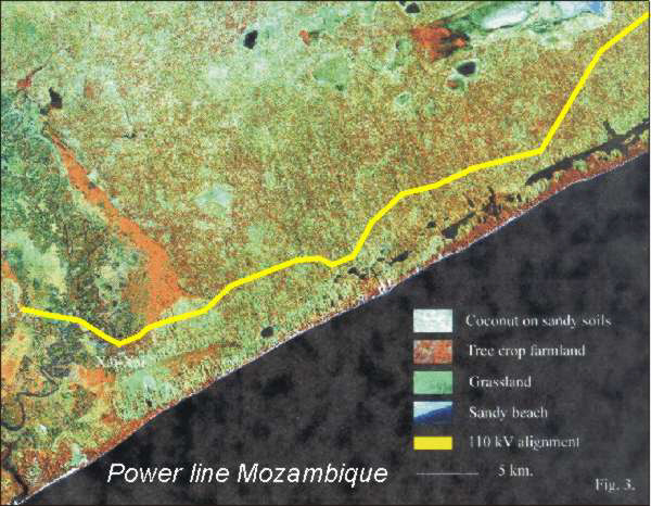
Landsat data used for placing a powerline in Mozambique.
privacy@prins engineering.com