MONITORING CORAL
REEFS AND SEA GRASS BEDS
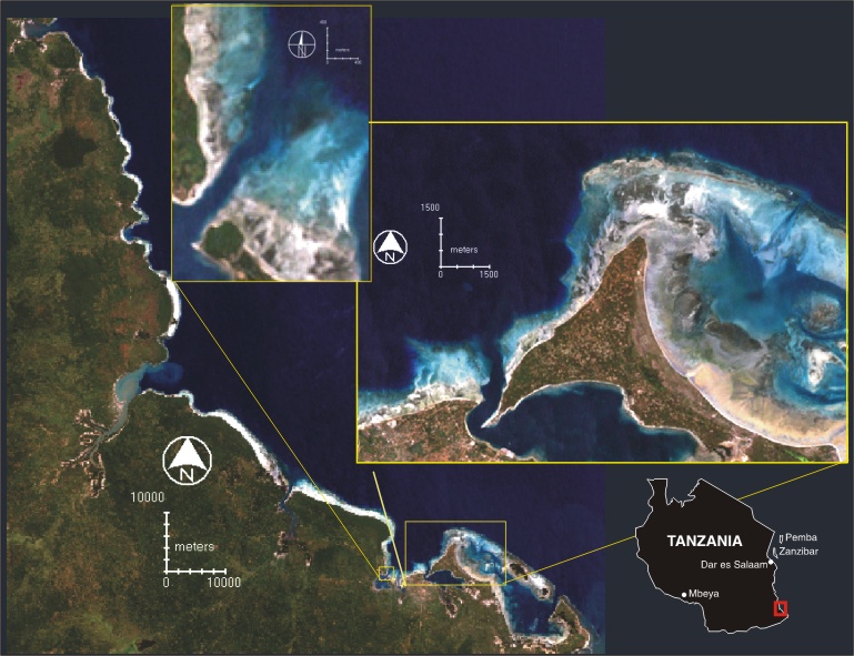
Coral reefs can automatically be mapped by the use of
Landsat data, the extent of biological rich reefs are normally very limited
compared to the extent of the reef.
We have the experience to map coral reefs and sea grass beds
from Tanzania and Egypt.
privacy@prins engineering.com