oil
field of Sudan -
block
3 AND 7
LAND USE CHANGES FOLLOWING DEVELOPMENT OF THE OIL INDUSTRY
In most of
southern Sudan is oil exploitation going on. Big oil fields are established
which has consequences for nature and local population.
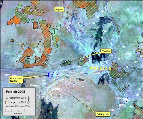
Paloich oilfield
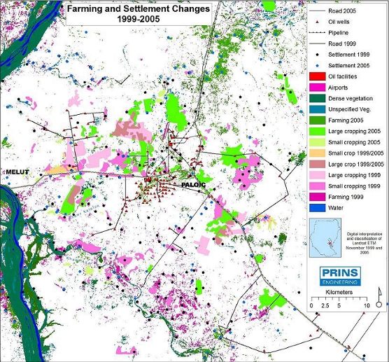
By comparing
Landsat images of November 1999 with November 2005, significant changes was
found in the agricultural use, settlement patterns and hydrology, the satellite
imagery analysis were verified by on site visits and interviews in the area.
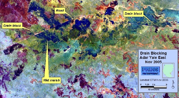
The Machar Marshes
are among the larges in the world and contribute to the draining systems of the
Nile, they have high nature value and the areas are used for small holder
agriculture and by nomads for winter grassing. Lately, oil has been found in the
areas and big programs have started for exploration of the oil. Satellite images
are excellent and a cheap measure to spot the consequence of the oil exploration
activities, including all weather roads which blocks and disturbers the natural
draining of the area.
Full
report
Client: The European Coalition on Oil in Sudan (ECOS)
privacy@prins engineering.com