MONITORING OF DEFORESTATION IN LATVIA
Since the
establishments of a new EU CAP in 1998 the E.C. have committed them to integrate
the environment into their agricultural policies. Presently, EU put big effort
into the establishment of agro-environmental indicators.
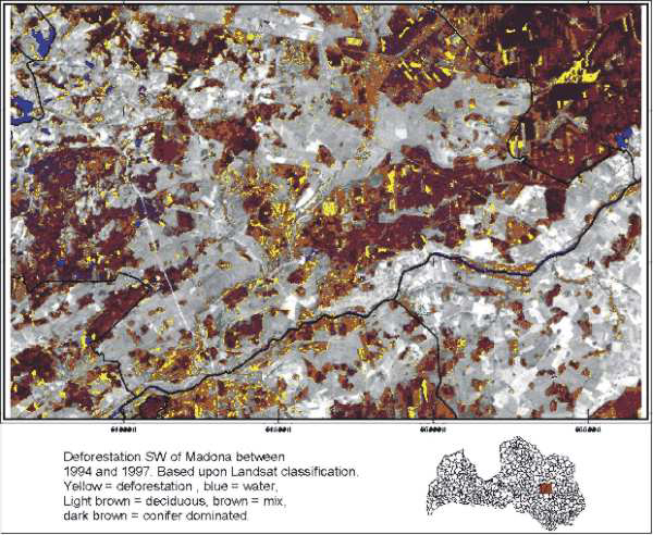
Landsat data used to map an area with deforestation
activities - the case used as a part of capacity building to Latvian government
institutions.
Since the
liberation of Latvia in the beginning of the 90'ties, there has been an
increasing export of wood - a few years
ago
Latvia
overtook Canada
as major exporter to GBR. Use of Earth Observation data
is a very cost
effective way to monitor
logging
amounts
and illegal logging
from protected areas.
Prins (2001)
Methods for indication of biological values and biodiversity in Latvian
farmland - Spatial analysis of land use/cover
and landscape in relation to distribution of birds in the farmland. Technical
report: Prepared for the project:
“management of biodiversity in the Latvian farmland – a decision support
system”by Erik Prins Febuary 2001.
DANCEE/Ornis Consult Ltd.
Aunins A, Kalviskis K and Prins, E. (2000): Telpiskas
informacijas sistemas un attala izpete, Latvian Fund for Nature, Riga 2000, ISBN-9984-9356-3-9. – First official
publication on
Earth Observation and
GIS in Latvian.
Client: DANCEE 1995-2001
privacy@prins engineering.com