BotaNICAL MAPPING OF Eastern ecuador
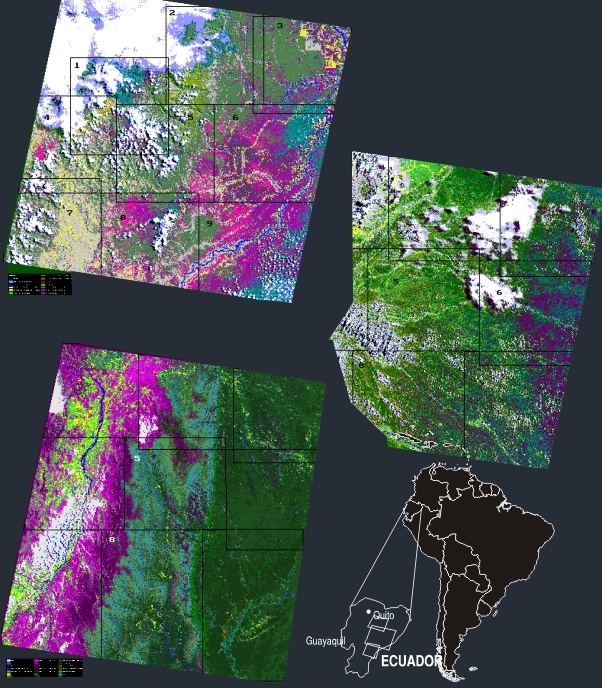
Ecuador is in
terms of biodiversity one of the richest place on Earth. We used Landsat TM data
and advanced digital enhancement techniques, to separate more than 30 vegetation
classes including more than 20 forest classes. The study revealed a very high
forest type diversity going up from the Amazone lowland up to the Andes. i.e.
some mountains had seven vegetation layers following the altitude.
The purpose of the
mapping was to provide an overview of habitat areas for further detailed studies
and integration into GIS.
The study has
implication for:
- Habitat
locations and analysis
- Biodiversity
assessment
- Land use/cover
mapping
- Species
composition and habitat mapping
Client: Danida Strategic Research program; DIVA.
Jan 1995 - July 1995.
privacy@prins engineering.com