Management tools for the
Water Framework Directive
Management of
nutrients
draining
in the
farmland has similarities
with
management of
biodiversity;
this
principally
encompasses
leaving
natural and semi-natural vegetation in buffer zones
along
boarders of streams.
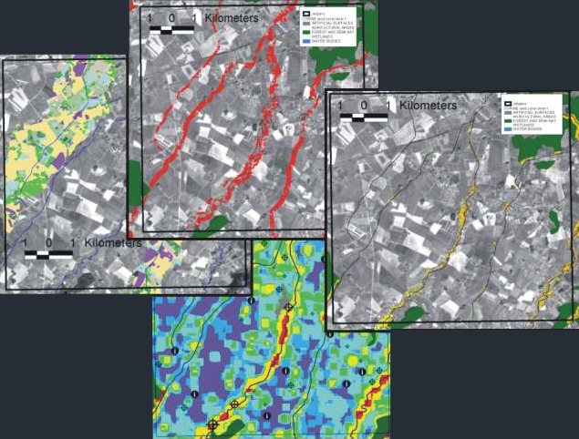
Landsat data were used to map the farmland including crops,
meadows, shrubs, forest and set-aside areas. Buffers around streams showed
favorable/unfavorable places for nutrients capture and areas which was favorable
for preservation of biodiversity in the farmland.
As a part of
the project
“Management
of Biodiversity in the Latvian Farmland - a decision
support
system”,
we demonstrated
relative
simple
and cost effective decision
support
systems for management
of
nutrient leaching and biodiversity in the
Latvian
farmland. Developed biodiversity filters
were used
on
farmland
and showed
a clear connection between biodiversity and nutrient management.
The system
easily monitors
buffer areas along
streams
which
have
importance for capturing nutrients and preserving biodiversity.
The approach
was
developed
locally
and
tested
on a national scale to
meet the
requirements of EU
Water Framework Directive and Integrated
Water Resources Management (IWRM)
new EU CAP.
Prins (2001)
Methods for indication of biological values and biodiversity in Latvian
farmland - Spatial analysis of land use/cover and landscape in relation to
distribution of birds in the farmland. Technical report: Prepared for the
project: “management of biodiversity in the Latvian farmland – a decision
support system”by Erik Prins Febuary 2001. DANCEE/Ornis Consult Ltd.
Client: DANCEE 1995-2001
privacy@prins engineering.com