deforestation
Rates in South West Madagascar
A study conducted to calculate rates of deforestation and land cover changes in
SW Madagascar based upon multi-temporal Landsat analysis 1973-96. The study used
Landsat TM and old Landsat MSS data which was Fourier transformed.
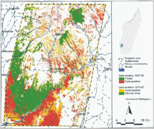
Landsat data used to calculate deforestation rates in
South-West Madagascar.
Client: Centre of Development Research/ Danida
Research Council
privacy@prins engineering.com