Selective cutting in miombo woodland
Together with Institute of Resource Assessment, University of Dar es Salaam,
we developed several satellite derived deforestation and dedradation measures
for miombo woodland during a University colloboration project
’Agricultural and Ecological
Consequences of Deforestation and Afforestation in Tanzania and Zambia
based on Satellite Remote Sensing'.
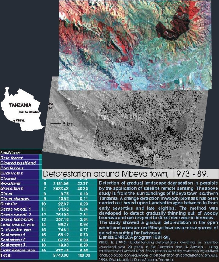
Landsat data used to spot degradation areas around Mbeya
Town in South Western Tanzania.
The miombo woodland
eco-environment is comparable more stable than the West-African Sudano zone,
which open up for biomass measures of miombo. By calibartion of annual images it
was possible to measure general increase or decrease in biomass in miombo
woodland. The study confessed that the Ujamaa villagisation was a prime course
to deforestation and degradation. The above example show decrease in wood
resources around the town Mbeya - most of the degradation was coursed by cutting
for fuel wood.
The results have
implications for biomass accounting and REDD.
Client: Danida
ENRECA programme 1991-94.
privacy@prins engineering.com