EIA OF SUDAN'S OIL FIELDS - Hydrological EFFECTS OF THE DEVELOPMENT OF THE OIL INDUSTRY
The
construction of allweather roads in connection with the oil exploration has
had a visible effect on drainage patterns in the Sudd and can as such be seen in
all areas of the Sudd, however, especially in oil block 5a, 4 and 3. Several watercourse
blockages can be spotted in the images in the form of moisture (low values in
Landsat band 5 and thermal band 6) that is trapped on one side of the raised oil
roads and thereby indicates disturbed natural drainage. One of the severe cases is north
of the Thar Jath oil field where a blockage more than 8 km long was first
observed in 2003 and has increased in 2004 and still present in 2006.
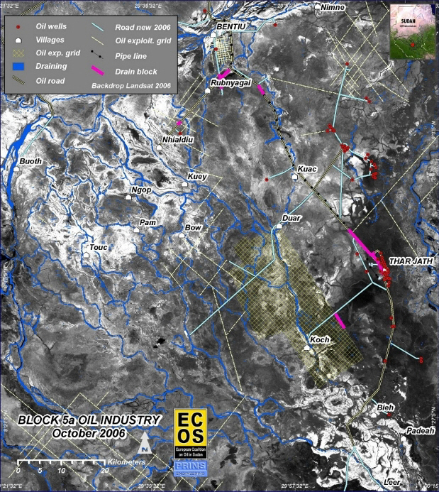
Development of oil industry in Block 5a - pink shows areas where water damming
was observed - coursed by road construction. In the background image (Landsat
ETM SWIR band 5) moist areas are the dark parts - it can be observed that the
Thar Jath oil field is placed on the very moist edges of the White Nile.
The hydrological changes at Thar Jath have been observed on
satellite images three years after the all-weather road was constructed and the
drilling/production started. Given the hydrological conditions in the area there
is a risk that the water may have been
polluted due to oil production, which would be of serious environmental concern
- especially as the White Nile River is only 5 km away. Resent released
information (CNN:
07-Dec-09) on oil pollution in block 5 support the concerns.
Furthermore,
from Landsat on the 8th November 2004 an irregularity was observed in the Thar
Jath oil field, when a thick black cloud with a 13 km black fane could be observed from one of
the boreholes. No burning or hot temperatures were observed from the spot and an
investigation for a ‘blowout’ and resultant oil spill should be made.
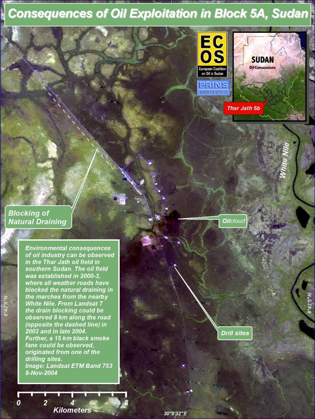
Thar Jath oil
field recorded the 8 of November 2004 - note the blocking of draining along the
road NE of the oil field. Furthermore, a big black cloud was rasing from one
of the bore holes and producing a smoke fane going in a SW direction.
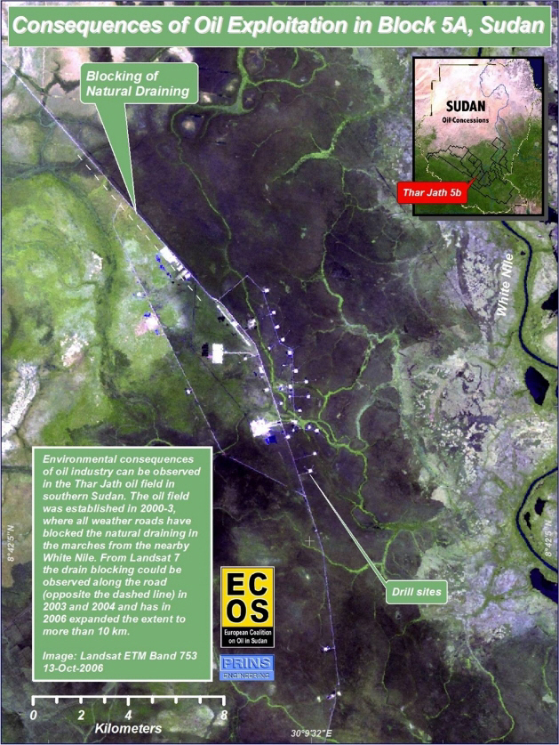
Thar Jath oil field recorded 13 October 2006 showing drain bloking on the
eastern side of the oil road.
DRAIN
BLOCKING EAST OF ADAR YALE OIL FIELD - BLOCK 3
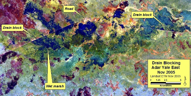
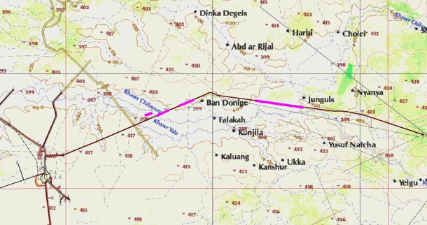
The upper
image show drain blocking in area 3 - observed from Landsat in late 2005, the lower
map show that the drain blocking (pink lines) was affecting one of the major
draining systems in the Sudd.
Client: The European Coalition on Oil in Sudan (ECOS)
privacy@prins engineering.com